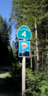
 Beloved Route 4, an east-west highway, begins in Hercules, Calif. at the I-80 junction as part of John Muir Parkway. The road is an expressway from its starting point until it approaches Martinez, at which point it becomes a full freeway (the California Delta Highway) passing Concord, Pittsburg and Antioch. After Antioch, the freeway turns northward to become State Route 60, and Route 4 separates to become a suburban and rural road passing through the Bay Area's outermost eastern suburbs (Oakley and Brentwood). Route 4 continues to Stockton, where it briefly joins I-5 and then enters a separate freeway routing almost directly through downtown Stockton. The route then multiplexes with State Route 99 before running eastward into the Sierra through Angels Camp and Calaveras Big Trees State Park. The route runs through the 8,050 ft. (2,454 m) Pacific Grade Summit on its way up to the 8,730 ft. (2,661 m) Ebbetts Pass and ends at State Route 89 ten miles west of Topaz Laek, on the California–Nevada border. The portion from Arnold to its terminus is designated the Ebbetts Pass Scenic Byway.
Through the mountains, Route 4 is not suitable for large trucks, buses, or RVs, as it becomes very steep and narrow (sometimes with no center dividing line), with tight twists and turns. This portion is also often closed in the winter due to snowstorms and snowpack. Additionally, the segment between Bear Valley Mountain Resort to Monitor Pass near Markleeville is completely shut down through the winter, until the snowmelt. (from Wikipedia)


